On this page:
Map of Cavan, 1837
This map is from the accompanying Atlas published in 1837 with the two volumes of Samuel Lewis's A Topographical Dictionary of Ireland.
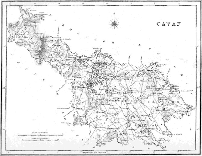
This PDF provides the same map in a much higher resolution:

|
Cavan map from Lewis 1837.pdf Size : 2649.958 Kb Type : pdf |
Civil Parishes of east Cavan
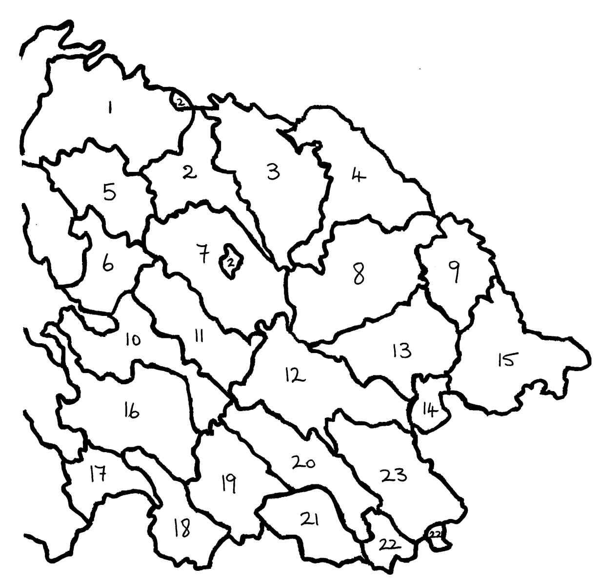
17. Ballymachugh 18. Kilbride
20. Lurgan 21. Munterconnaught
23. Mullagh
1. Annagh
2. Drung
3. Kildrumsherdan
4. Drumgoon
5. Castleterra
6. Annagelliff
7. Laragh
8. Knockbride
9. Shercock
10. Denn
11. Lavey
12. Killinkere
13. Bailieborough
14. Moybolgue
15. Enniskeen
16. Crosserlough
19. Castlerahan22. Loughan of Castlekeeran
Go to ancestryireland for a map showing the civil parishes for all of Co. Cavan.
Townlands for Killinkere Parish, Co. Cavan
1. Carricknamaddoo
2. Greaghnafarna
3. Moylett
4. Lurgananure
5. Termon
6. Derryhum
7. Gola
8. Coolnacola
9. Greaghadoo
10. Greaghadossan
11. Lismagiril
12. Greaghclaugh
13. Assan
14. Tievenaman
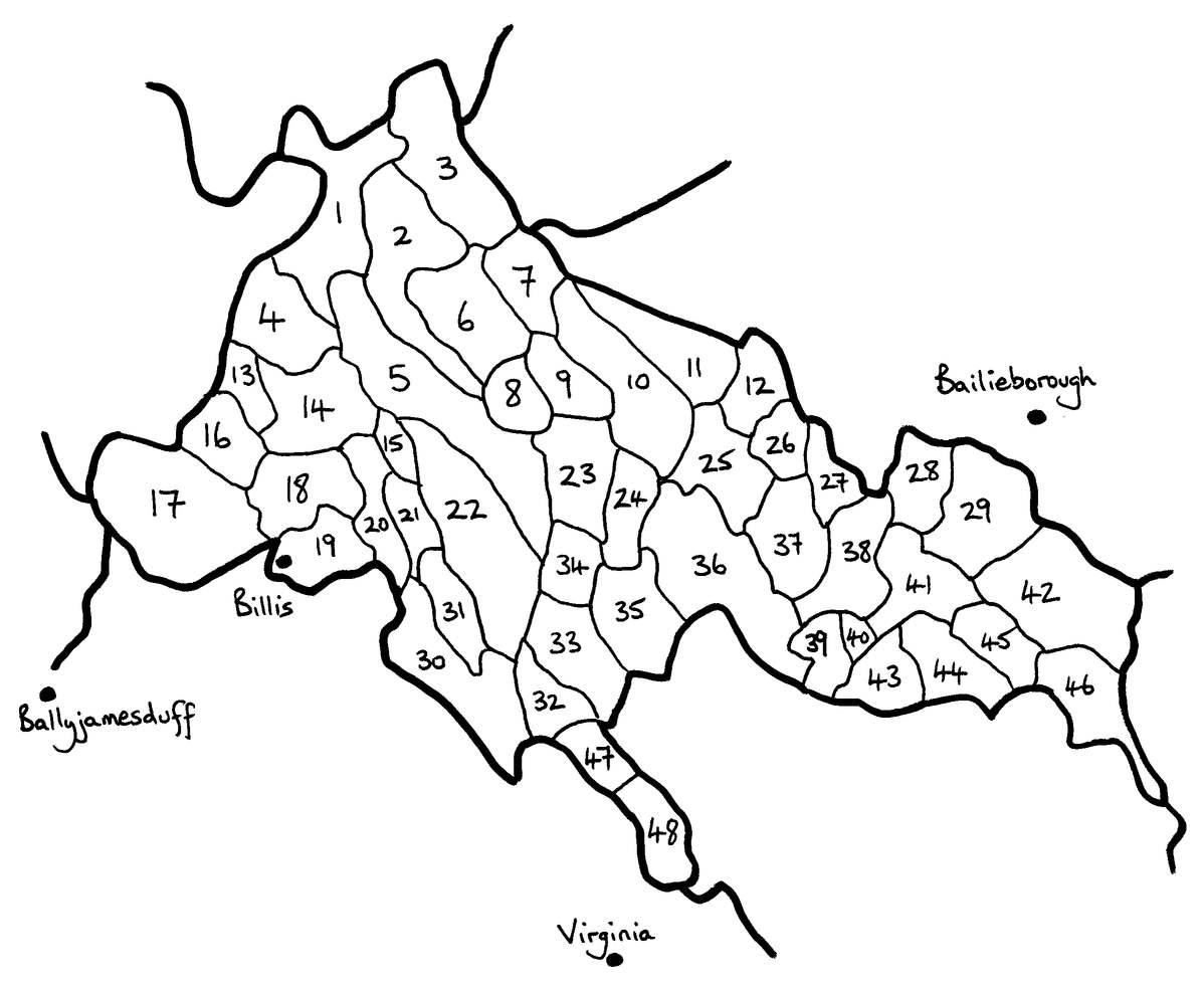
18. Carrickeeshill
21. Lateaster
24. Greaghnacunnia
27. Greaghduff
30. Drumagolan
33. Kilmore
36. Beagh Glebe
39. Corradooa
42. Carnagarve
45. Lurganaveele
48. Lisnabantry
19. Billis
22. Lissanymore
25. Cleffin
28. Drutamy
31. Corraneden
34. Gallon
37. Carricknaveagh
40. Pottleduff
43. Invyarroge
46. Finternagh
20. Lissacapple
23. Cargagh
26. Galloncurra
29. Carnalynch
32. Streamaquerty
35. Corratinner
38. Carrickgorman
41. Togher
44. Fartadreen
47. Burnew
Map of Ballyjamesduff - Virginia - Bailieborough
Please note that Beglieve has been misspelt as Belglive!